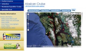
 In response to demand from travelers, Adventure Life has launched a custom online mapping feature. This new tool utilizes Google satellite maps to pinpoint water routes and remote landing sites for small ship cruises that navigate small coves and inlets. Adventure Life travelers can now trace and follow the routes for remote cruises in Alaska, Antarctica or Galapagos, among other destinations.
“In the past, our travelers booked small ship cruises with without access specific details regarding the intricacies of an actual route a ship would take,” said Adventure Life’s General Manager Jonathan Brunger, “With this new technology, we can provide a detailed visual representation of the exact route a vessel will take, all the way down to a specific beach or cove they might visit. Travelers can even zoom in to see the roof of a research stations or boulders on a specific beach.”
This is a ground-breaking tool for small ship cruise companies, as mapping capabilities have previously been limited to larger cruise ships visiting metropolitan areas or well-known ports of call. The technological innovation allows for mapping of remote fjords, penguin colonies, or specific research stations and lodges.
